Tag Archives: Auckland

Tending the weather

Last week, even before winter had officially begun, Auckland woke up to its coldest day in 40 years. We know this fact thanks to weather stations like the one in Albert Park in the city centre. I was in the park on that remarkably cold day, and stopped to admire this gorgeous weather vane.

100B3274


It is the centrepiece of a meteorological station that has stood on the highest point in the park since 1909. Albert Park was once the site of a fortified Maori Pa and in the 19th century an army barracks. In fact the army began recording the colony’s weather on this same site as early as 1854.

Another feature of Albert Park is the floral clock – dating from 1953: if it looks a little bit sparse it is because it had recently had its annual overhaul and replanting.

100B3270

Albert Park lies between the grounds of Auckland University and the CBD so it hums, especially at lunchtime, with students and office and shop workers alike.

In spite of the cold, the fabulous cloudless sky had drawn the crowds to the park – to stroll, read, meditate, meet, and, around the onion-domed band rotunda, to enjoy a pop concert put on by university music students.

100B3275 100B3277

Nestling under a broad branched tree between the fountain and the band rotunda stands this delicate statue of Love breaking Hate’s sword. It is dedicated to 19th century Auckland journalist George M Reed and was erected in 1901, a few year after his death. Those haunting, oft-quoted lines by Reed’s fellow journalist George L Banks are engraved on its pedestal.

100B3276

… for the future in the distance and the good that I can do.

Advertisement

The Domain – Auckland’s green heart

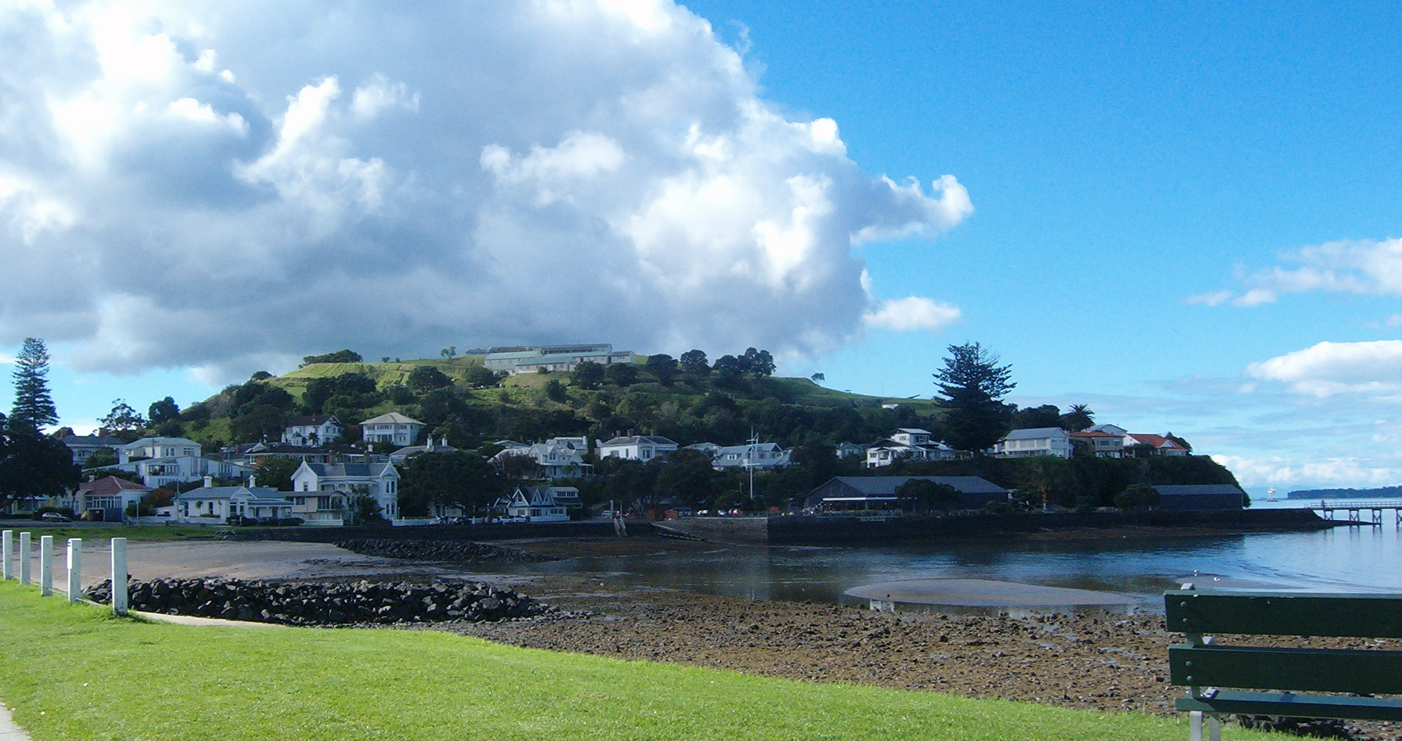
Auckland Domain is the city’s oldest park: created in the 1840s and covering three quarters of a square kilometre (185 acres), it is a pulsating green heart.

100B3207

Much more than just flower beds, trees and open spaces it is as well an open book illustrating Auckland’s multi-faceted history. The Domain’s site is an extinct volcano, Pukekawa: when European settlers arrived it was a strategic defended pa site for the local Maori, and the swampy crater lake meant that even during a siege they had a water supply, and food from eels. The Ngati Whatua tribe sold the land to the Europeans and in 1843, thanks to the governor general’s far-sightedness, it became a place for the public to enjoy in many different ways.

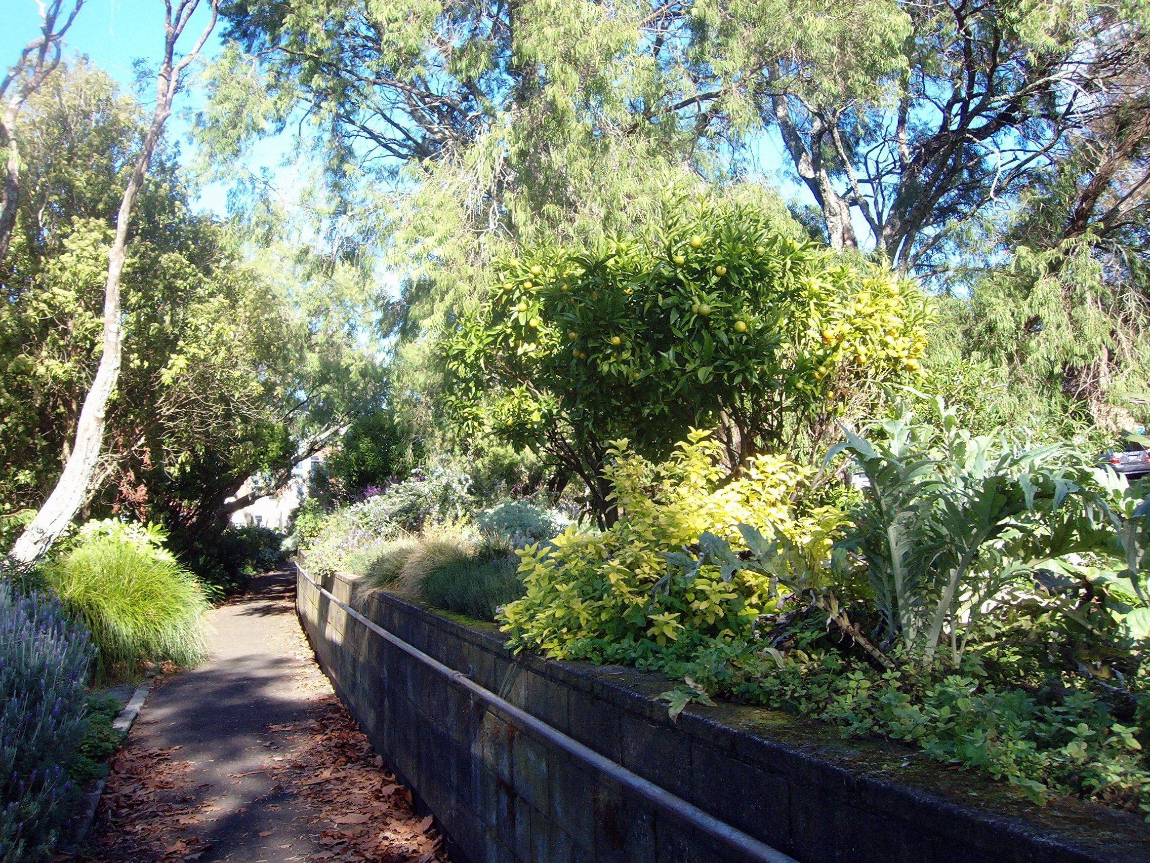
In 1866 the spring water from the crater lake was channeled into the city’s first piped water supply – this spring still feeds the duck ponds. These days the ducks share this part of the Domain with some geese.

100B3210 100B3211

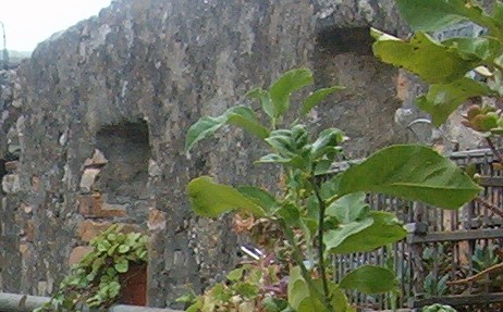
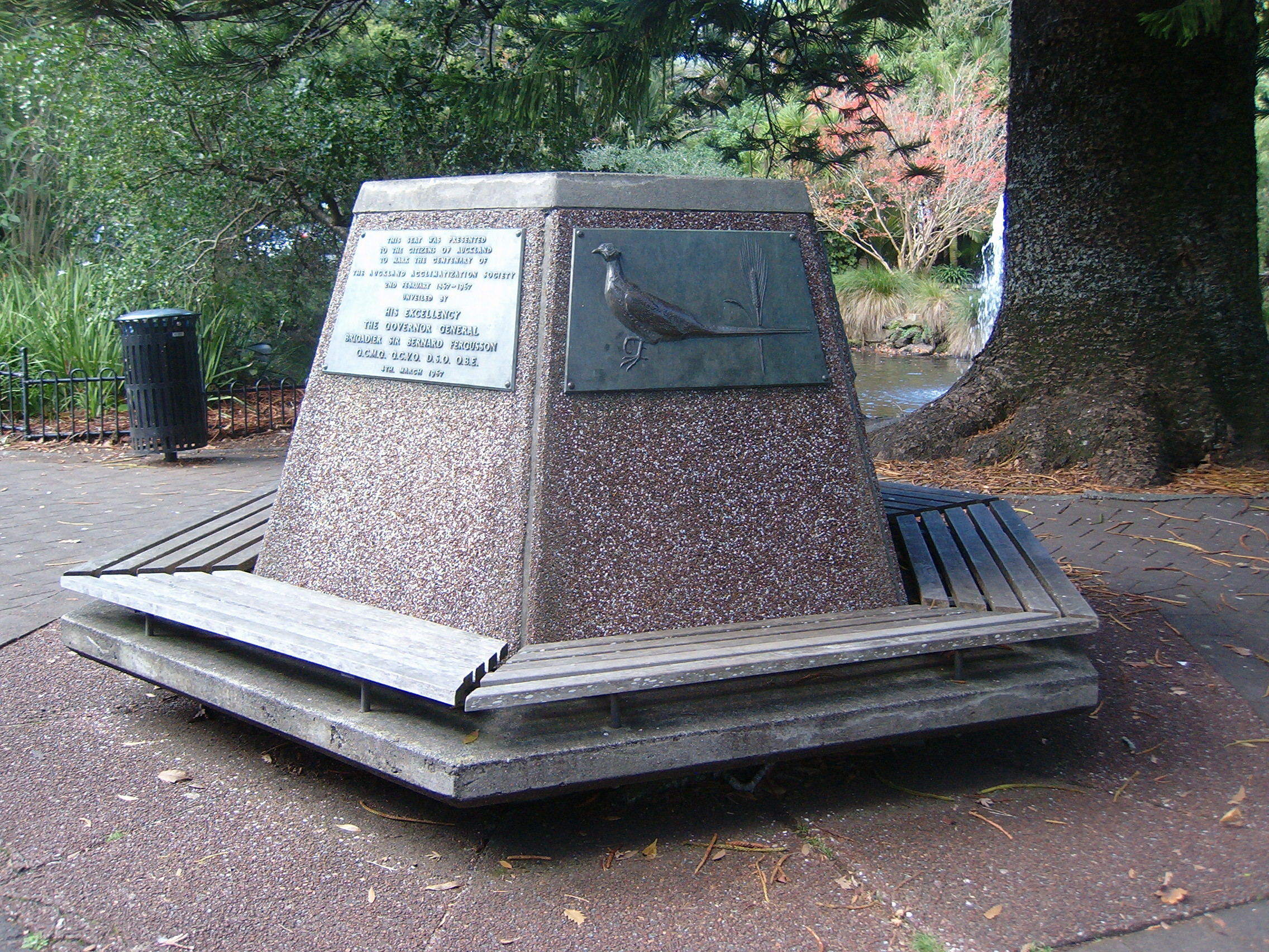
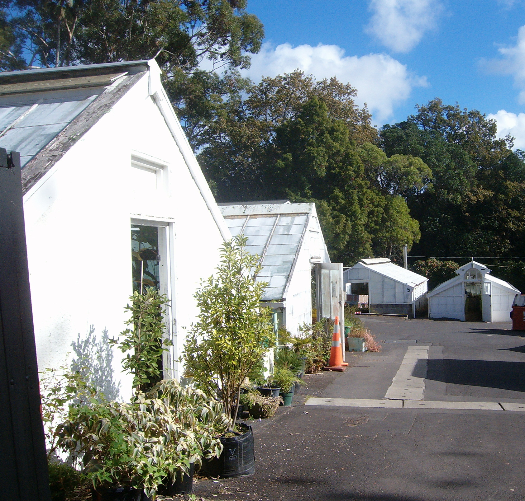
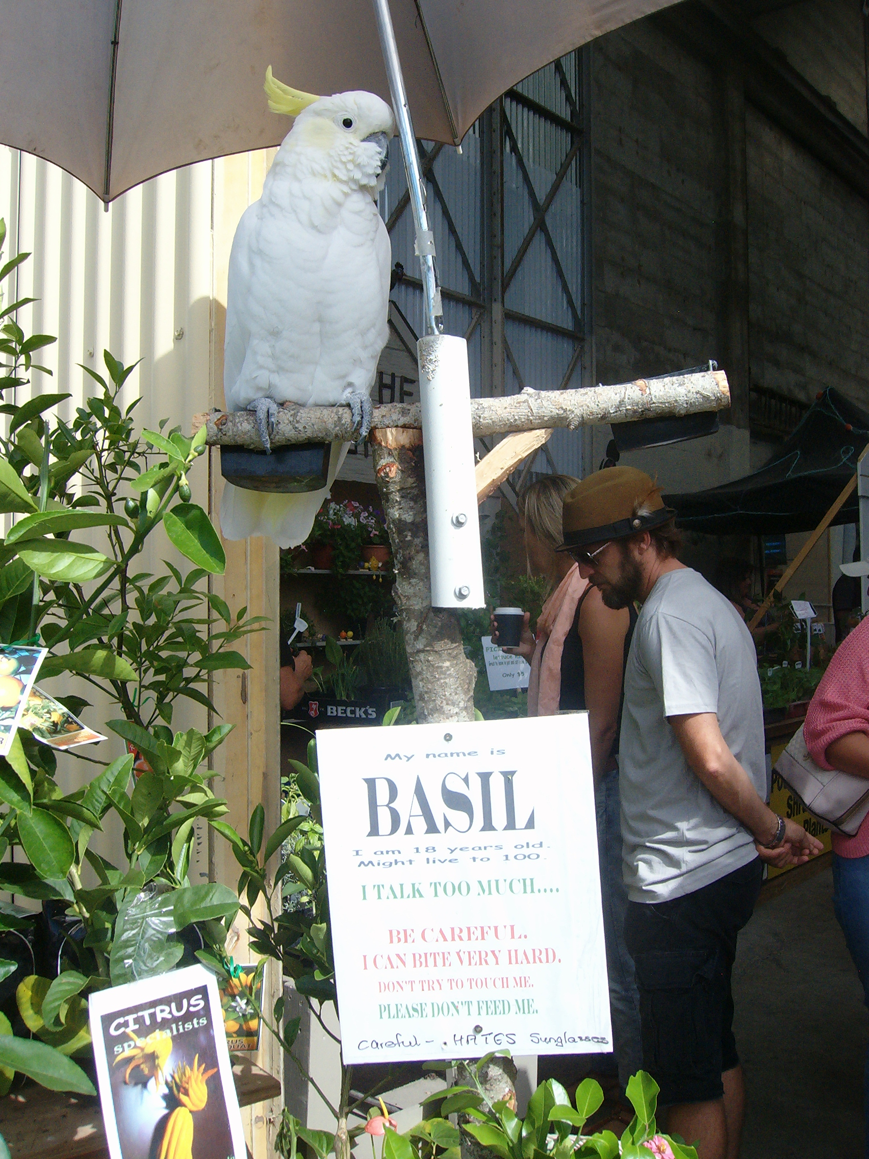
In the 1860s the Auckland Acclimatisation Society established a nursery in the Domain – some of the nursery buildings date from that time. The Acclimatisation Society introduced European trees and ornamental plants to New Zealand as well as song and game birds.  Californian rainbow trout were imported in 1883 and the eggs hatched in the Domain ponds created the base stock for trout fishing waters throughout the country. This bench commemorates the society’s work.

100B3228 100B3222

(The nursery buildings (above, right) are not open to the public)

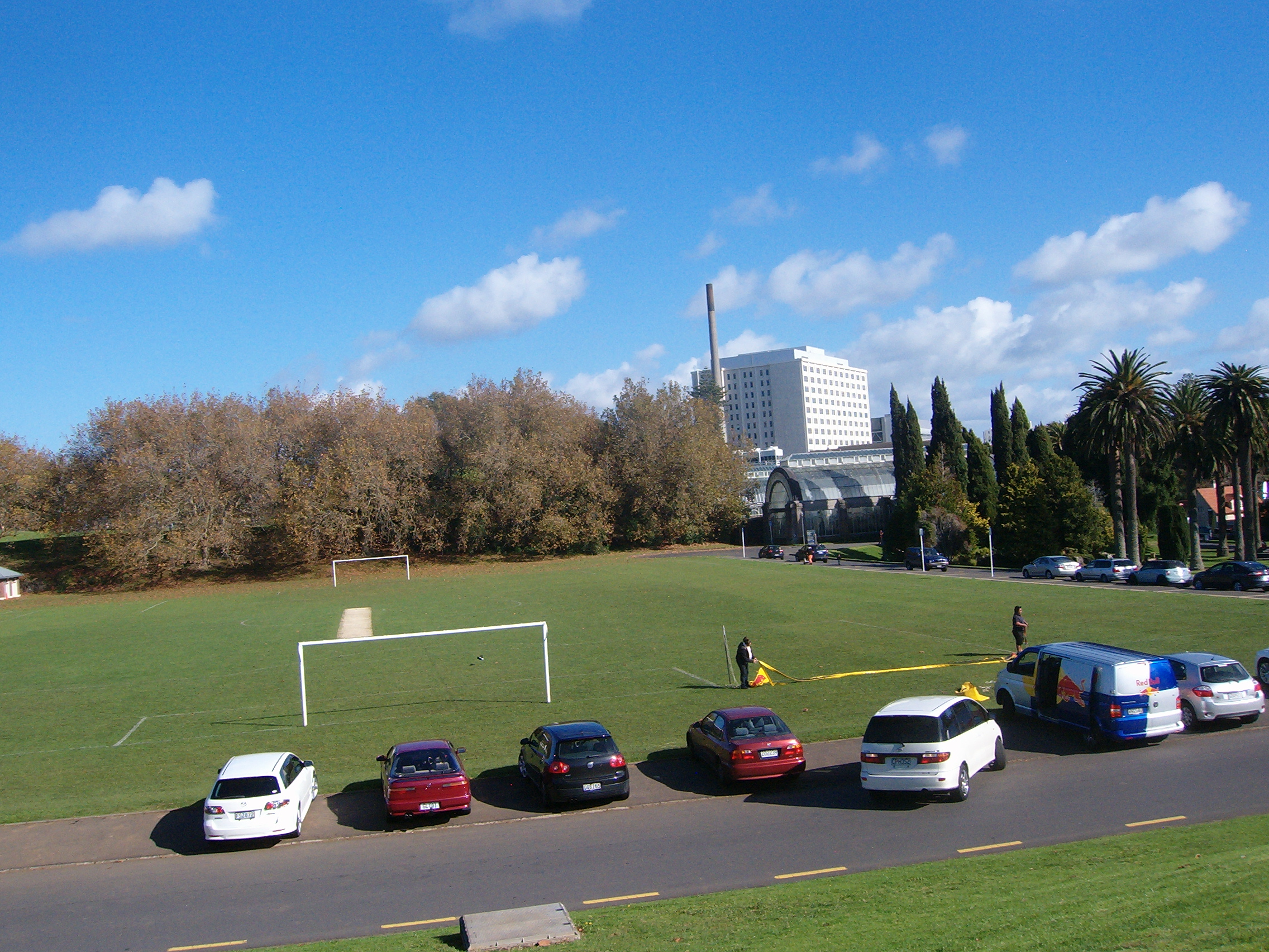
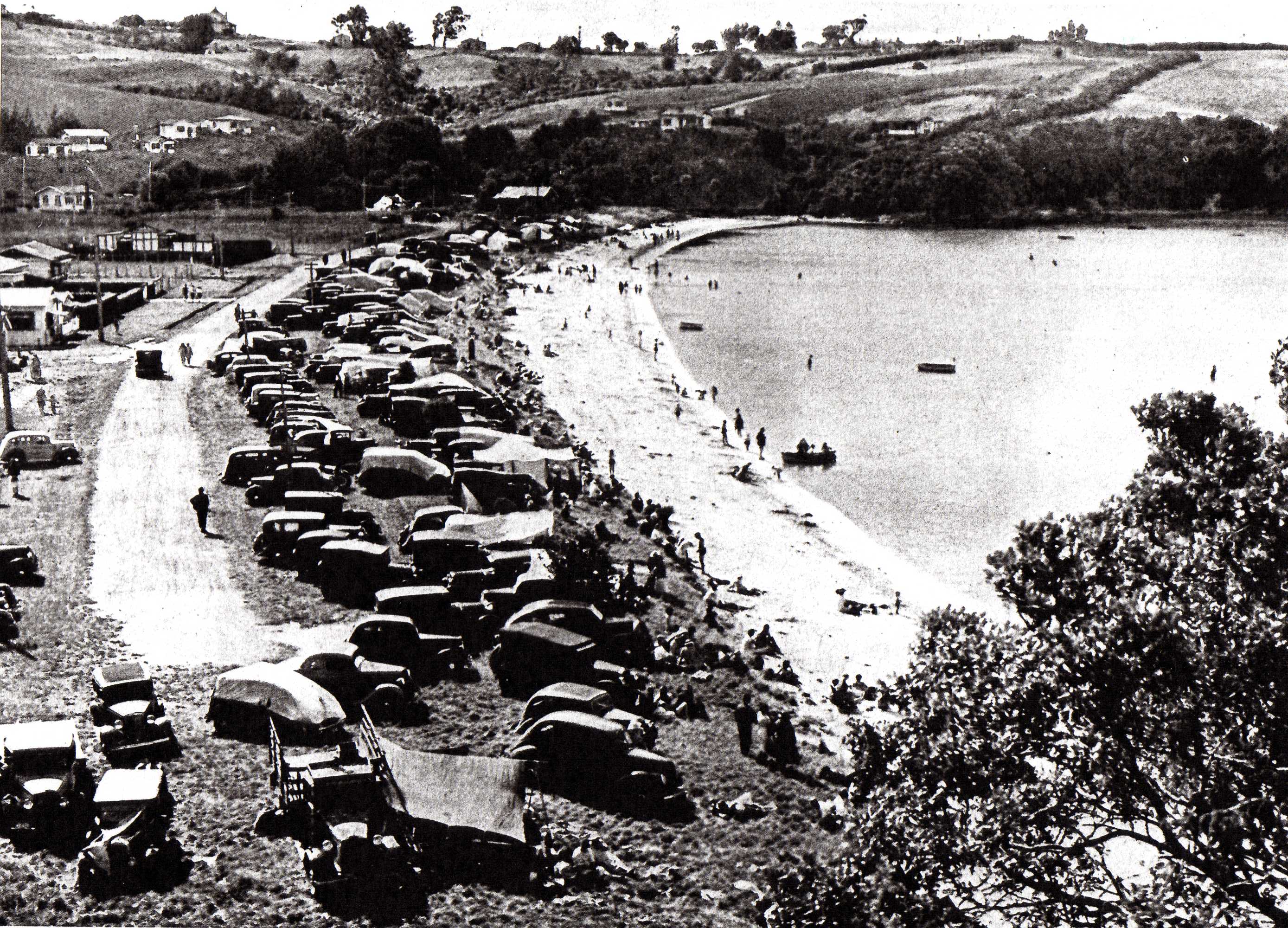
Once the water supply had been harnessed, the crater lake was drained and converted to sports grounds. Today’s cricket pavilion dates from 1898 (replacing an earlier one that burnt down) while the grandstand seating is named in honour of Charles Kerr, and Auckland cricketer who played on the Domain pitch for 61 summer seasons. Tennis and rugby followed cricket with the lawn tennis club opening in 1872 and Auckland’s first league game being played here in 1910. The small hump in the centre of the playing fields is the volcanic core, Pukekaroa.

100B3202 100B3249

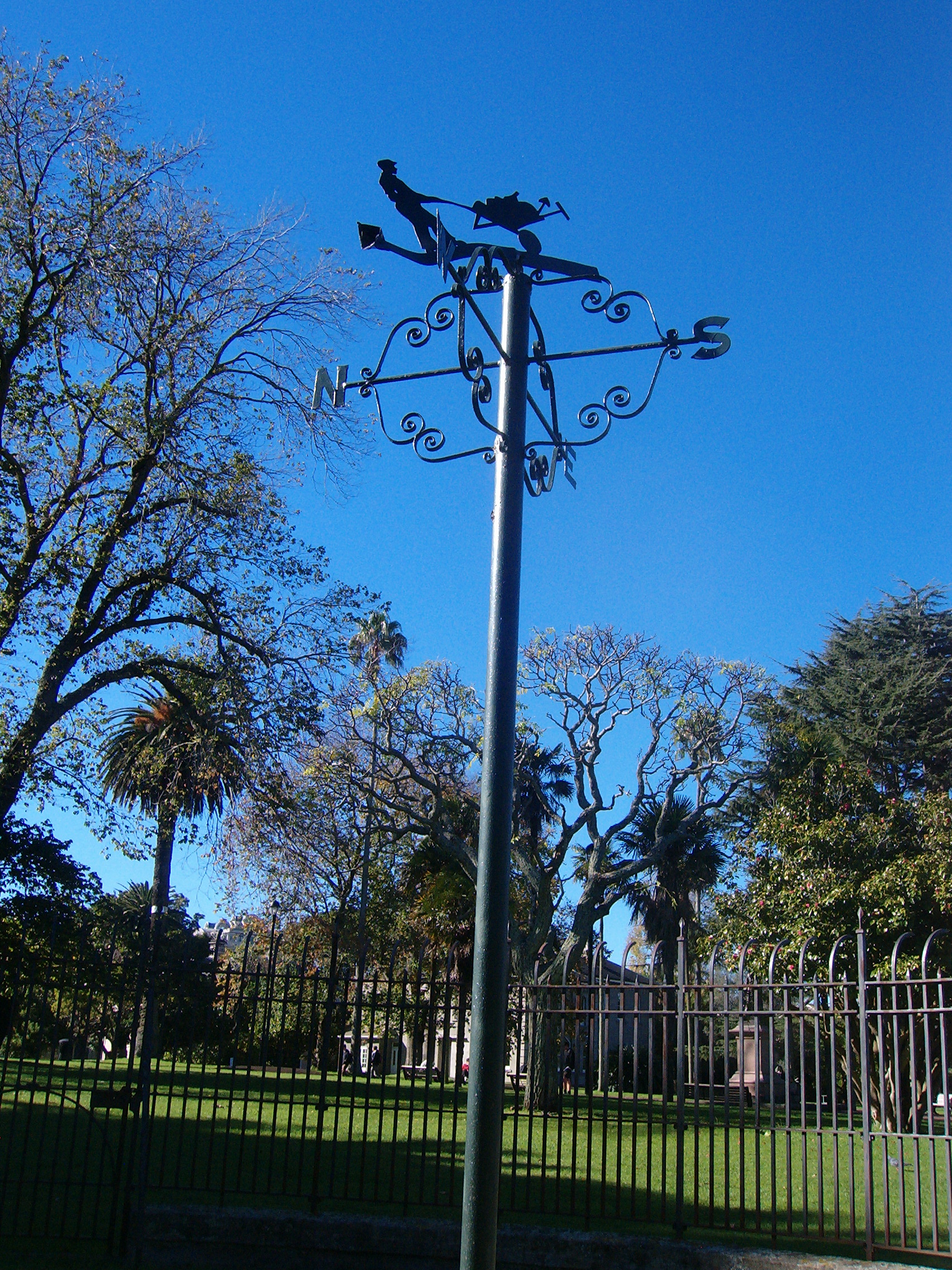
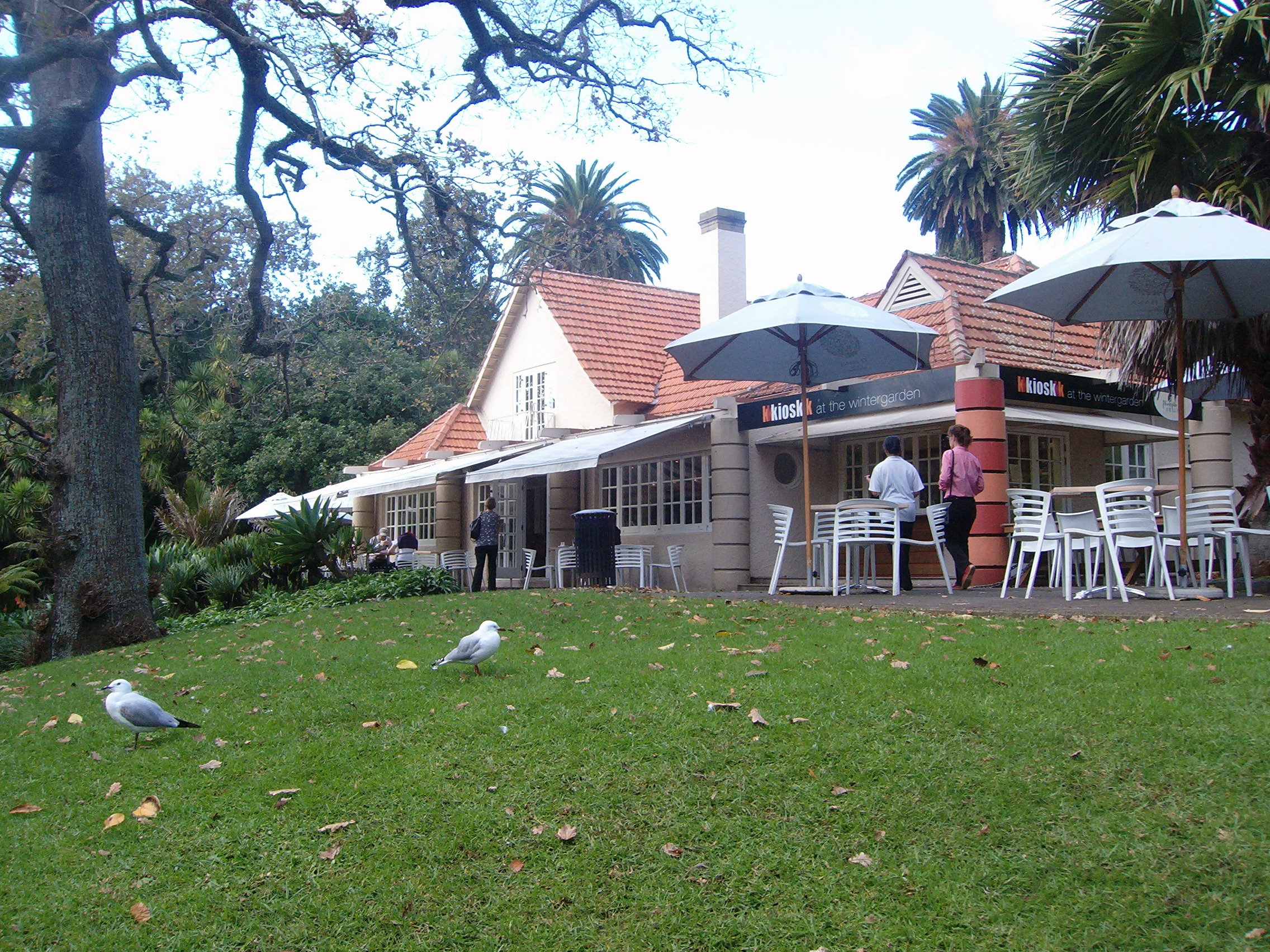
The great event of 1913-14 was the Auckland Industrial, Agricultural and Mining Exhibition. Although the city’s population was then only around 100,000, nearly 900,000 visitors came to see the exhibition. After the event everything was dismantled except the ideal home show house which is the very popular ‘Wintergarden Pavilion’ tea kiosk today, www.wintergardenpavilion.co.nz , and the band rotunda.

100B3229 100B3206

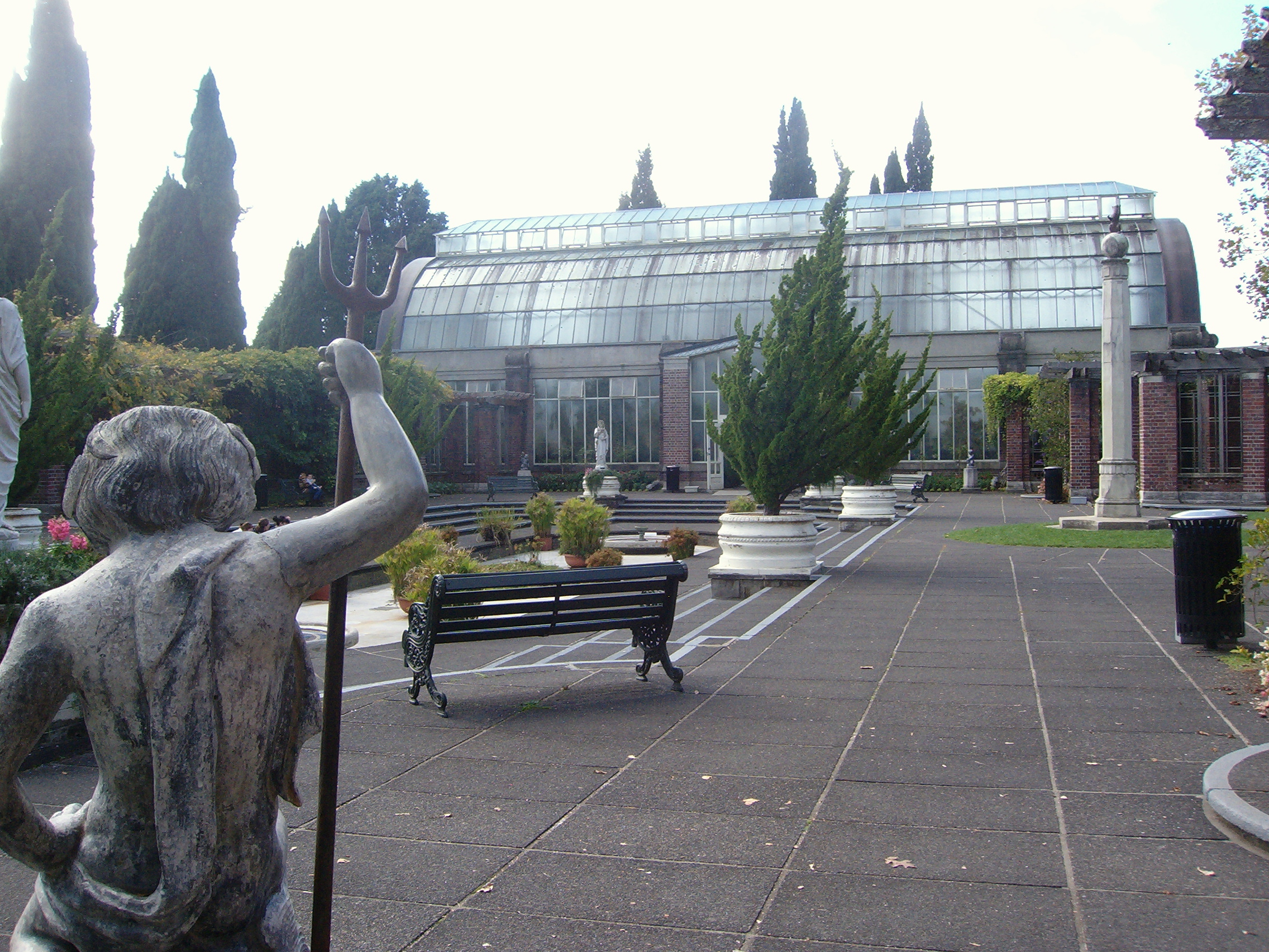
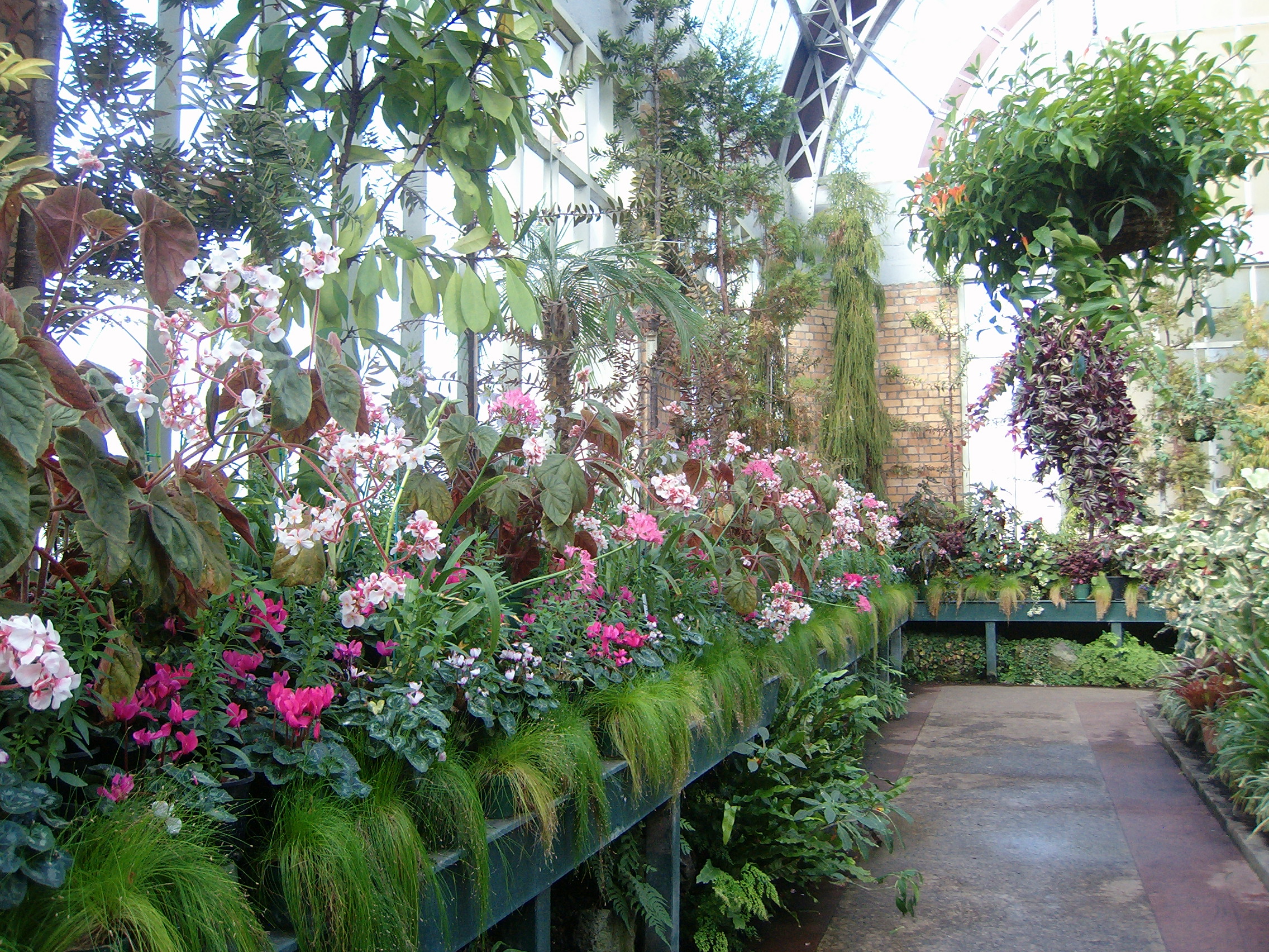
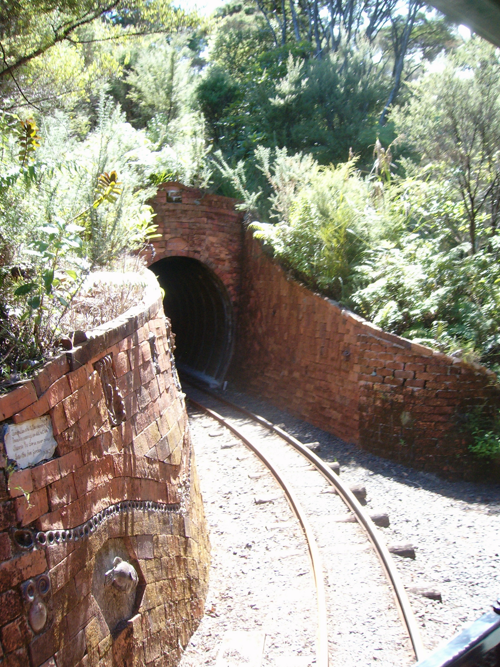
When World War I ended, funds from the Exhibition were invested in the creation of the Winter Garden – two green houses, a cool one and a tropical one. An open-air fernery lies in a sunken quarry between the green houses – the quarry was the source of gravel for building paths and roads through the Domain.

100B3234 100B3231 100B3243  100B3235

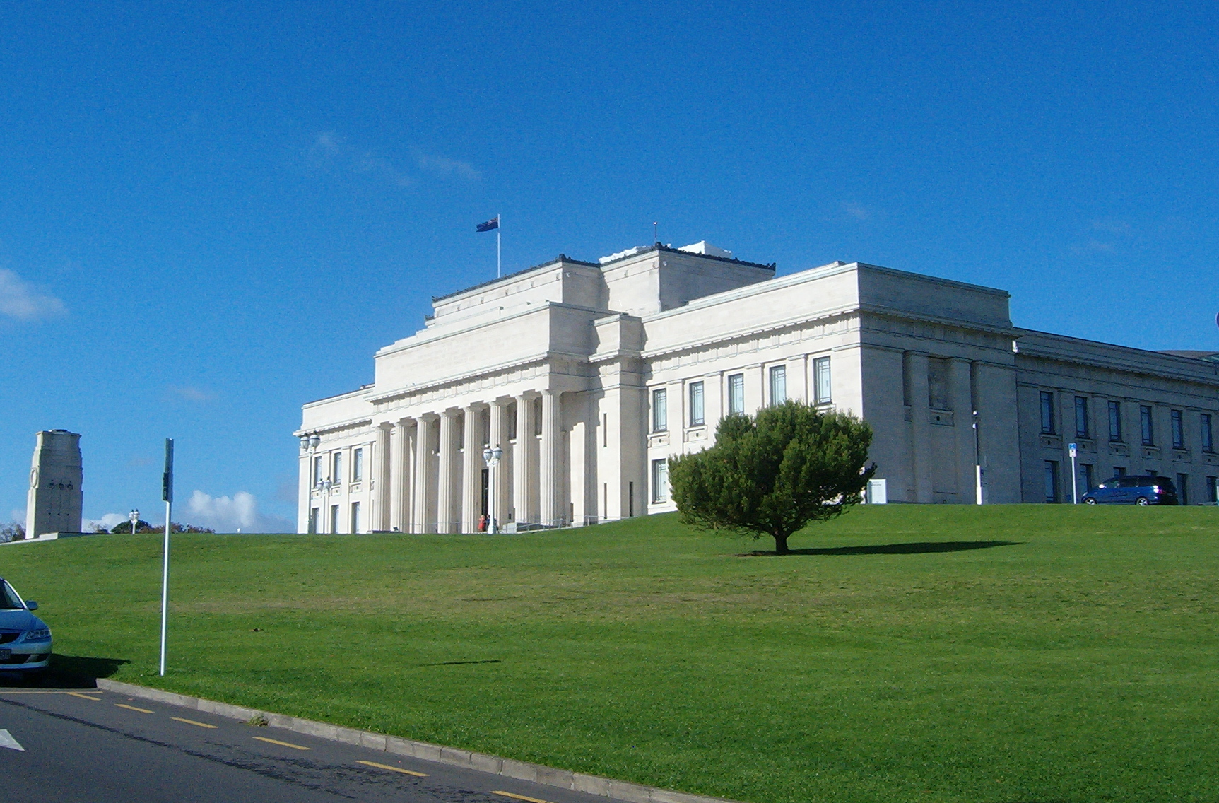
Following World War I the War Memorial Museum was built on the highest point in the Domain, with the cenotaph and consecrated ground in front of it overlooking the Waitemata Harbour. After World War II the museum was enlarged.

 100B3203 100B3199

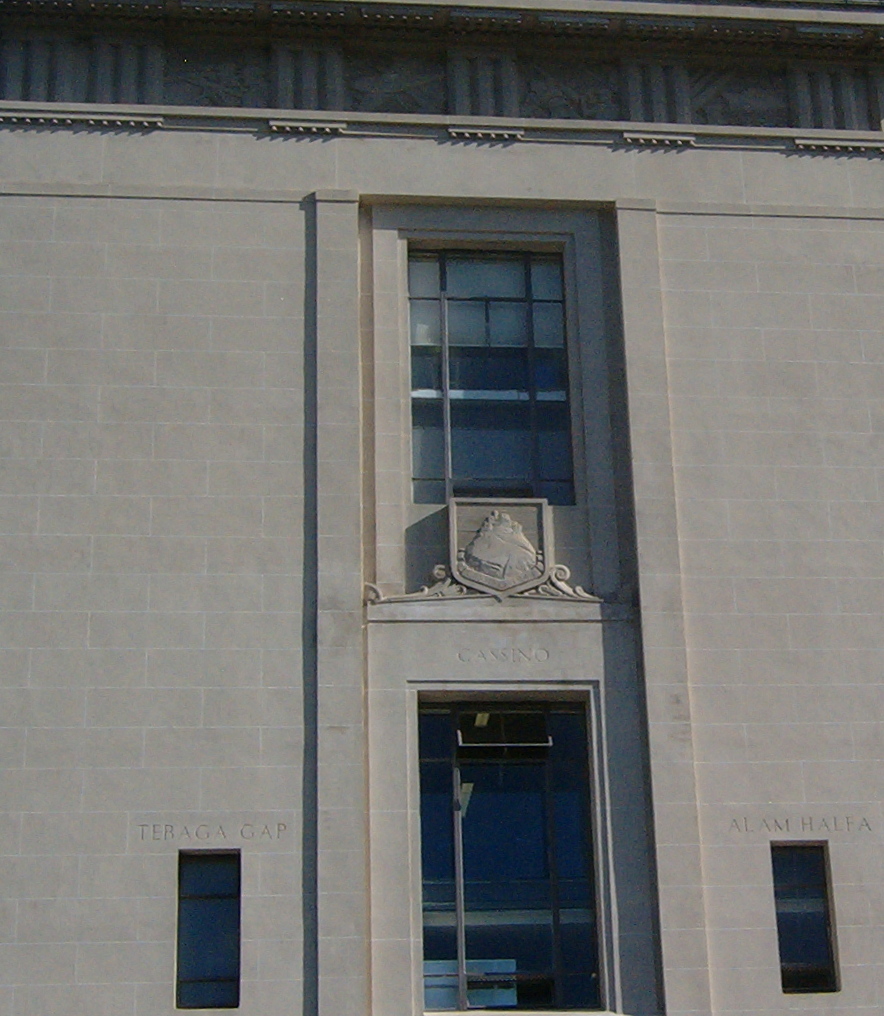
(detail, above right, of War Memorial Museum’s east wall with windows dedicated to the battles of Monte Cassino, Italy (centre), Tebaga Gap, Tunisia (left) and Alam Halfa, Egypt (right) and a freize depicting the army, navy and airforce along the top)

Auckland businessman William Elliot donated funds for the monumental gateway which was opened in 1935. New Zealand athlete Alan Elliot was the model for Richard Gross’s statue.

100B3252

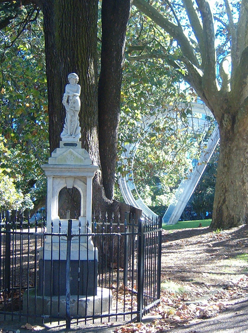
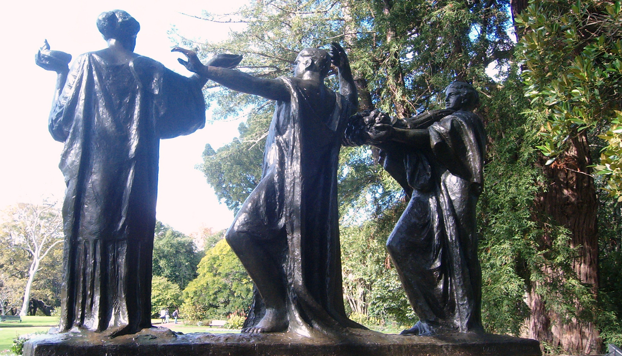
Auckland’s centennial year (1940) was marked in the Domain with this statue by WH Wright. The figures represent the city’s strength, flanked by fertility and wisdom.

100B3218 100B3221

The statue stands in the Watson Bequest Garden, a tranquil, enclosed garden near the Domain’s wooded area. In a secluded garden-within-a garden, opening off the Watson Bequest Garden, stands the tiny, but mighty, Valkyrie statue. Although four park benches surround the statue and its fountain, three or more people at a time in this space certainly feels like a crowd. The engery exuded by the bronze horse and the gracefulness of its rider are captivating.

In 1890 the Royal New Zealand Foundation for the Blind had established its premises on the Domain’s eastern boundary. This Sensory Garden, opened in 1970, is an example of the ongoing evolution of the Domain.

100B3196


Tunnelling into North Head

North Head, in Devonport on Auckland’s North Shore, stands like a sentinel at the mouth of the Waitemata Harbour. Like neighbouring Mount Victoria, and the long since quarried away Mount Cambria which stood between them, North Head is an extinct volcano. The Maori who settled in the area named it Maungauika and built a fortified pa on it. Looking at North Head today, its strategic importance is still easy to appreciate.

100B2519 100B3157

The view on the left was taken from the summit of Mount Victoria, looking over the summit of North Head and down the Hauraki Gulf: Auckland on the right, Waiheke Island on the left and Coromandel Peninsula in the distance. On the right, North Head from the waterfront in Devonport.

It commands an unbroken view not only of the harbour, but also of a wide sweep of the Hauraki Gulf, stretching northwest and southeast and bounded all across the horizon by a string of islands.

100B3163 100B3159

Some of the views from North Head, including (below) Rangitoto Island and downtown Auckland

100B3164 100B3177

What is totally hidden from the foot of this grassy, rounded hillock is that it is riddled with tunnels. They date from the 1880s: in fact no sooner had the British settled in Auckland than they had to defend the young colony from the threat of a Russian invasion.


100B3187 100B3166

Tunnel entrances and one of the better-lit tunnels. Not all the tunnels are well lit and a torch is handy.

100B3175  100B3188

One of the features of the defence structures on North Head were the ‘disappearing guns’. When they were fired the recoil was such that they ‘disappeared’ down into a pit and were concealed from the enemy. Actually, the enemy was also concealed from the men operating these 8-inch guns: look-outs sheltering under a little metal umbrella higher up the hillside sent instructions to the gun crew through a talking tube.

100B3169 100B3171

The ‘disappearing gun’ seen from inside its cavity, the ‘control tower’ further up the hill (below left), and (below right) the gun emplacement from above. the gun could swivel around to face up and down the Harbour. 

100B3180 100B3183

As it turned out, the Russians never approached Auckland, but the garrison was kept in place and was brought back into service during the first and second World Wars. Although the threat of a Japanese attack towards the end of WWII was a real possibility, this didn’t eventuate.100B3184

100B3185

In 1972 North Head was handed over the Conservation Department. Despite its military origins it is a delightful place to visit. Three well signposted paths take in the main features – the coastal walk encircles the hill at sea level, while the tunnels and summit walks intertwine for exploration of the garrison and gun emplacements. On the summit a video in the Stone Kitchen Theatre recounts Maungauika-North Head’s history from pre-European times and includes dramatic reconstructions of the volcanic eruption of Rangitoto Island and of the ‘disappearing guns’ in action.

Roses are red and yellow and pink and …

The Parnell Rose Gardens adorn part of a headland above central Auckland’s busy container port. Dove-Myer Robinson Park – consisting of the rose gardens, the  Victorian era Gillies family home and its wooded grounds in Gladstone Road – seems a world away from the nearby city centre. Some of the trees surrounding the Gillies home (now a restaurant and reception venue) are among Auckland’s oldest and largest.

100B3114 100B3120

Manuka (Kunzea ericoides) and its tiny white flowers (above) and a gigantic pohutukawa covering many square metres (below) and seen from outside and inside.

100B3116 100B3117

100B3118

Another giant tree is this Australian Bunya Bunya pine (araucaria bidwillii)

100B3148 100B3147

The rose gardens are best visited from November to  April, but with this year’s mild autumn, they are still beautiful at the moment.

100B3106 Colourbreak floribunda

above – unnamed and Colourbreak; below – Just Joey and two views of Peace, or more correctly Madame A Meilland created in France during World War II.

Just Joey hybrid tea Peace 100B3129

At this time of year the leaves and hips are just a pretty as the roses.

100B3130 100B3108

Below – Blue Moon, Beach Baby and Cheerful Days

100B3131  Beach Baby floribunda Cheerful Days hybrid tea/floribunda

100B3140 Guy Savoy

An overview of the gardens and  Guy Savoy, a variegated rose.


Birdwatchers’ paradise

Like me, you’ve probably driven past certain places often enough, wishing there was time to stop and nosey around. Usually another destination is calling – have to get here, have to get there – and that intriguing spot is left behind for another day. For me one of those places is the Miranda Shorebirds Coast on East Coast Road about 60 kilometres south east of Auckland. I’ve driven past so many times, looking longingly at gleaming strip of white shells that defines the coastline.  Thousands of birds gather here over our summer to escape the winter in Alaska and Siberia and to feast on a rich seafood diet. When they return north in March other migrating birds arrive from closer to home, leaving New Zealand’s South Island for the milder North Island winter climate.

100B3020

This crushed-shell road  runs parallel to East Coast Road between Kaiaua and Miranda

So the coast line between Miranda and Kaiaua is a birdwatchers’ paradise and I really enjoyed the day we spent picnicking there last week.

100B3023

Self-contained camper vans (ie with on-board toilets) can stay for 2 nights overlooking the Firth of Thames. In this photo there are just a handful – during the summer months when the birds have gathered there can be thirty or more vans parked along here.

The drive out to the coast is lovely: we left east Auckland through Howick, turned right at Whitford, and left at Brookby onto Twilight Road. This scenic route wends through native bush to Clevedon and from there it’s on, across rolling farmland, through Kawakawa Bay to Kaiaua. The abundance of yellow-eyed mullet here (aua in Maori, while kai means food or eating) gave the settlement its name, as these fish thrive in the Thames estuary. Leaving Kaiaua, there are plenty of places to park along the shelly beach overlooking the Firth of Thames. This is a lonely, windswept stretch of coast, with not a house is sight and very few trees, and yet as the tide went out, leaving the mudflats glistening in the afternoon sun we appreciated its peaceful, enigmatic beauty and admired the clouds reflected on the seabed.

100B3026 100B3025

Looking across the Firth of Thames at low tide to the Coromandel Ranges and towards Thames.

The birds followed the tide out, so this was a good place for binoculars. We recognised oyster catchers, pied stilts and of course a variety of gulls: ideally we would have been there nearer high tide when it’s so much easier to identify the birds! In late afternoon the sun picked out every fold and ridge in the rugged Coromandel Peninsular. The coastal town of Thames seemed suddenly so close across the Firth’s deep bluey-green waters. When it was time to head home we decided to go back the way we’d come. However a complete loop would have been to continue on along the coast to Waitakaruru. This would have taken us past the Miranda Shorebirds Centre (www.miranda-shorebirds.org.nz) and Miranda Hot Springs, and from Waitakaruru north to Pokeno and then up the motorway back to Auckland. So either way, there is plenty of interest to make this a really enjoyable day out.

‘Nduja and other gastronomic delights

‘Nduja!

It’s the last thing I’d ever have expected to find at Hobsonville Point Farmers Market, but as the free taster – I’m told by the stallholder that it’s a sort of chorizo – melts in my mouth I recognize it instantly, as much by its texture as by its flavour. A specialty of southern Italy’s Calabria region, ‘nduja is finely ground pork meat and fat turned bright orange and fiery by the addition of ground chili pepper and spices. Unlike salami which can be thinly sliced, ‘nduja (pronounced “in-do-ya”) is soft and spreadable – delicious on a cracker or stirred into a pasta sauce or stew. And being so hot, a little goes a very long way.

100B2944

‘nduja New Zealand style from Farm Gate Products http://www.the farmgate.co.nz

As well as ‘nduja, Farm Gate Produce make delicious sausages from free-range pork and beef, and stock great manuka-smoked bacon too. They are one of the many friendly stalls at Hobsonville Point Farmers Market and it’s inspiring to see so much locally produced and really delicious food: cheeses, breads, sweets (Magnolia Kitchen’s rocky road and edible marshmallow clouds are a real treat – http://www.magnoliakitchen.co.nz) , honey (loved Earthbound Honey’s manuka honey – http://www.earthboundhoney.co.nz), jams, relishes and sauces, olive oil, snack foods and of course home grown seasonal fruit and vegetables.

100B2935 100B2936

NZ-made mozzarella and scamorza and pizza from a portable wood-fired oven

100B2939 100B2945 100B2946 100B2938

eggplants, cheeses, bagels, olive oil, fresh bread – the mouth waters constantly

100B2947

Salash Delicatessen is a family business with Serbian origins. Their sausages and salami range from mild to hell hot – my favourite. http://www.salash.co.nz

Every Saturday and Sunday from 9am to 1pm Hobsonville Point Farmers Market takes place in and around a giant ex-airbase hangar, breathing new life into a building that was decommissioned when the New Zealand Air Force moved away from its helicopter and seaplane base there in 2002.

100B2943 100B2954

18-year-old Basil keeps an eye the market activities.

100B2956 100B2953

Hobsonville Point, in Auckland’s west and on the innermost reaches of the Waitemata Harbour, is one of the city’s newest suburbs. The development’s well-chosen slogan is “Moments away, a world apart”. During the week this is entirely true: it’s a 25-minute ferry ride between downtown central Auckland and the Point’s new all-tides wharf.

100B2930 100B2933 100B2980

Taking the ferry up the Harbour, under the Harbour Bridge, past Chelsea Sugar Refinery, to step off the wharf where the market is held.

By car or bus I imagine it’s rather more than just moments away, but it certainly is worlds apart – the Air Force buildings (hangars, barracks, married officers’ houses and the Base Commander’s house) and open spaces remain as part of the suburb’s unique identity, making it completely different to any other emerging residential area in Auckland. Panels along the covered wharf recount the area’s history and Virginia King’s Hinaki eel trap sculpture on the wharf is one of several that make up the urban décor.

100B2959 100B2964

This giant stainless steel dog by Steve Woodward stands in front of the soon-to-be-renovated barracks. Below one of the fine houses which were built for the married Air Force officers.

100B2965 100B2976

Virginia King’s Hinakieel trap extends through a hole in the wharf, down towardsthe sea. It is encircled by Fiona Farrell’s poem Eel.

100B2941  100B2940

The Radar Station has become a children’s activity centre, complete with aircraft-inspired wall paper.

For now the ferry service doesn’t run at the weekends but when the Farmers Market organisers put on a special event, such as last weekend’s “Doggy Day Out”, a charter ferry service runs for a very reasonable NZ$10 return, making a trip to Hobsonville Point and its market well worthwhile. And as with all great food markets it really pays to go early and buy early – stocks of specialist goodies do run out towards closing time.

100B2967 100B2942

Coromandel highlights

The ‘360° Discovery’ ferry to Coromandel, a catamaran, clips purposefully down Auckland’s Waitemata Harbour on a dead calm sea. Brief stops at Waiheke Island’s Orapiu wharf and at Rotoroa Island are soon, like mainland Auckland, far behind. Ahead, as the cat crosses the Firth of Thames, rise the mountains of the Coromandel Peninsula. To the south, where the mountains fade into the horizon, there is only a faint, hazy hint of the Hauraki Plains. Gannets dive for fish and little blue penguins frolic endearingly. Islands – lush and large and small and craggy – are strung along the Coromandel coast, so the township only comes into view as the ferry approaches Hannaford’s Wharf, inside the island haven.

100B2906 100B2863

Just two and an half very pleasant hours after leaving Auckland we arrive in Coromandel at lunchtime. The town was named after HMS Coromandel – in turn named after eastern India’s Coromandel Coast. The ship visited the area in 1820 to take on kauri timber for masts. Until then, the village was known by its Maori name, Kapanga.

Coromandel is the birthplace of New Zealand’s gold mining era. Charles Ring discovered gold in October 1852 and although he managed to keep his find secret for a while, Coromandel was soon inundated with prospectors, traders … everyone and everything needed in a bustling gold mining town with a population of around 10,000. Sadly the deforestation which had begun with the milling of the ancient kauri forests for masts and ship building accelerated during the mining days and again when forested lands were cleared for farming.  

100B2914 100B2919 100B2917

Although there are fewer than 2,000 inhabitants today, many of the buildings of the mid-late 1800s remain, making Coromandel both fascinating and appealing. Green-lipped mussel farming and tourism have both boosted the town’s economy in recent years. And very gradually, through planting programmes and natural second growth, the forest is regenerating.  A great ways to see how the native forest is growing over hillsides that were completely bare in the early 1900s is to take the narrow gauge (38cm) Driving Creek Railway (DCR) ride. Artist, engineer and conservationist, Barry Brickell began building the railway over 35 years ago as a way to get clay out of the hills for his pottery. At the same time he started replanting native New Zealand trees – to date 37,000 trees have been planted by Barry and his helpers. The railway line is now a very popular tourist attraction – it wends its way  for 3 kilometres through the bush and tunnels, over bridges (including a double-deck one) and zig-zagging line to the Eyefull Tower – a viewing platform surrounded by forest and with magnificent views in all directions.

100B2885 100B2849 100B2861 100B2853

Coromandel Highlights – part 2 coming soon


Panmure – from Mokoia Pa to the notorious roundabout

The shoreline of the Waitemata Harbour, around which the city of Auckland sprawls, features a number of tidal inlets and estuaries. One of these is the Tamaki River estuary – it winds so far inland that at its head it is only a few hundred metres from Auckland’s other, southern, harbour, the Manukau.

Long before Europeans came to this region of New Zealand, Maori legend tells us that Te Moko Ika A Hiku Waru was a taniwha, a water spirit, that guarded the mouth of the Tamaki inlet. This creature gave its name to a strategic knob of land overlooking the estuary: Mokoia Pa was a fortified settlement there, home to the Maori Ngati Paoa people. In the 1820s the pa was attacked by a northern tribe and destroyed, and its inhabitants killed.

100B2708

Looking across the Tamaki River to Mokoia Pa site (to the right of the bridge). In the foreground the remains of an early 1900s cattle yard.

Little more than a decade later Europeans began to show an interest in the area. The Surveyor General, Felton Mathew, was keen to establish the young colony’s capital near the abandoned pa site. However Governor Hobson chose a site further west around the Waitemata Harbour, and the city of Auckland was founded there. Meanwhile frequent skirmishes between the native Maori and European settlers meant that the defense value of the strategic Tamaki estuary site wasn’t overlooked. Retired British soldiers were brought to New Zealand to help protect the colony. They were known as Fencibles, and by the mid-1800s Fencible families were living along the shores of the  estuary, near the former Mokoia pa site, in ninety-nine temporary huts made from bundles of Raupo swamp reeds. Thus the settlement of Panmure was created.

100B2736

As the Fencibles’ conditions improved they built better homes, mostly in wood. This is an unusual example of one in local volcanic stone. It was built near Panmure in 1854, and moved to its present site in Panmure in the 1970s by taking it apart and rebuilding it stone by stone. It is furnished in the style of the 1850s as a memorial to early settlers.

100B2543

With water transport preferable to the hazards of travelling overland, the Tamaki River played a key part in the new settlement’s development. For over a century, until the mid-1900s, the Panmure wharf was used by cutters and scows to bring in supplies and to take away produce.

100B2714

Crew from these vessels would frequent Panmure’s pub. The first of these was built in the 1860’s. In those days it was a much more attractive building than in today’s photo as it had covered verandas on the ground and upper floors. This wooden pub was replaced by the current Panmure Hotel in 1865, and the older building remained in use as Loomb’s Hotel until 1890.

100B2546   100B2719

St Matthias Anglican church dates from the mid-1800s too, as do some of the graves in its adjoining cemetery.

100B2737

Panmure Basin is an almost-circular tidal volcanic crater – a break in the crater rim connects the lagoon to the Tamaki estuary. The basin is edged by a shaded walking path.

100B2728 100B2731

Looking across the Panmure Basin volcanic crater lake at high tide. The path that circuits the lake crosses this little bridge where the lagoon flows into the Tamaki estuary.

For motorists, the roundabout on Panmure’s western boundary can be a little bit daunting: some drivers will even go to great lengths to detour this multi-road intersection. If you enjoy the challenge of getting into the right lane to negotiate Auckland’s largest and most infamous roundabout be warned: it is about to be replaced by traffic lights.

100B2725  100B2723

With work well underway to remove the traffic roundabout, the sign this stands in its centre needs a new home.

Strolling on the sea bed

At high tide on a calm day if you’re standing near the water’s edge you may notice the sea give a little jiggle, an extra ripple or two, as if to say I’ve made it on time. Then it turns and it’s on its way out again: out and out for just over six hours until it reaches the low tide mark. As the shoreline drops away with the outgoing tide the sea becomes shallower and the sea bed is revealed. On exposed ocean beaches the sea bed is sandy and you can walk right down to the low tide mark and paddle. In other parts of the coast fabulous rock pools are revealed as the tide drops: kids of all ages love peering into their depths for crabs and shrimps. Sometimes, on more protected inner harbour beaches squelchy, slippery, slidy mudflats separate the beach from the receding tide and Cockle Bay would probably be one of these … if it weren’t for the cockles.  How many million and trillions of cockle shells are there? Cockle Bay, in east Auckland, is one of my favourite beaches. There are crushed cockle shells all along the shore – some quite large chips higher up the beach, and more finely crushed shells nearer the water’s edge. About an hour after high tide the flat seabed is gradually uncovered and this too is covered with cockle shells so that you can walk all the way out to the low tide mark accompanied by the crackle and crunch of the shells breaking beneath your sandals.

Carolyn Ellerslie2

This photo shows Cockle Bay beach a short while after high tide. The high tide mark is identified by the narrow  line between the lighter and darker bands of beach.

100B2562 100B2565

Cockle shells cover the beach.

100B2595 100B2596

I took these two photos from the same spot on the sea bed at dead low tide – just over 6 hours after high tide – the beach and the water’s edge are a long way off!

100B2603 100B2604

Tiny sea creatures have left their tracks in the sand as the tide receded.

100B2598 100B2599

This massive piece of wood is completely waterlogged so that it can no longer float. It has its own little pool complete with seaweed.

100B2601

img 031 Cockle Bay 1 Jan 1939045

There’s nothing new about picnicking at Cockle Bay! This is January 1939!