Category Archives: Uncategorized

EBOOKS and Calendars for 2015 coming 16th August to Auckland Independent Book Festival

See you there, 100 Victoria Road, Devonport, Auckland, 9am to 4pm. My stall is entitled “Italian Riviera inspired Ebooks” but I’ll also be promoting Dad’s books, ‘The Gentle Giants’ and ‘Blasts from the past’.  And if you can’t make it, maybe you’d like to check out my ebooks and calendars on this blog. My ebooks are on Amazon.com for PC and Kindle and on CreateSpace.com in paperback format. My calendars are on Lulu.com
100B3308 100B3311 100B3325ORIGINAL COVER GG

Advertisement

Coromandel highlights

The ‘360° Discovery’ ferry to Coromandel, a catamaran, clips purposefully down Auckland’s Waitemata Harbour on a dead calm sea. Brief stops at Waiheke Island’s Orapiu wharf and at Rotoroa Island are soon, like mainland Auckland, far behind. Ahead, as the cat crosses the Firth of Thames, rise the mountains of the Coromandel Peninsula. To the south, where the mountains fade into the horizon, there is only a faint, hazy hint of the Hauraki Plains. Gannets dive for fish and little blue penguins frolic endearingly. Islands – lush and large and small and craggy – are strung along the Coromandel coast, so the township only comes into view as the ferry approaches Hannaford’s Wharf, inside the island haven.

100B2906 100B2863

Just two and an half very pleasant hours after leaving Auckland we arrive in Coromandel at lunchtime. The town was named after HMS Coromandel – in turn named after eastern India’s Coromandel Coast. The ship visited the area in 1820 to take on kauri timber for masts. Until then, the village was known by its Maori name, Kapanga.

Coromandel is the birthplace of New Zealand’s gold mining era. Charles Ring discovered gold in October 1852 and although he managed to keep his find secret for a while, Coromandel was soon inundated with prospectors, traders … everyone and everything needed in a bustling gold mining town with a population of around 10,000. Sadly the deforestation which had begun with the milling of the ancient kauri forests for masts and ship building accelerated during the mining days and again when forested lands were cleared for farming.  

100B2914 100B2919 100B2917

Although there are fewer than 2,000 inhabitants today, many of the buildings of the mid-late 1800s remain, making Coromandel both fascinating and appealing. Green-lipped mussel farming and tourism have both boosted the town’s economy in recent years. And very gradually, through planting programmes and natural second growth, the forest is regenerating.  A great ways to see how the native forest is growing over hillsides that were completely bare in the early 1900s is to take the narrow gauge (38cm) Driving Creek Railway (DCR) ride. Artist, engineer and conservationist, Barry Brickell began building the railway over 35 years ago as a way to get clay out of the hills for his pottery. At the same time he started replanting native New Zealand trees – to date 37,000 trees have been planted by Barry and his helpers. The railway line is now a very popular tourist attraction – it wends its way  for 3 kilometres through the bush and tunnels, over bridges (including a double-deck one) and zig-zagging line to the Eyefull Tower – a viewing platform surrounded by forest and with magnificent views in all directions.

100B2885 100B2849 100B2861 100B2853

Coromandel Highlights – part 2 coming soon


Fencible life

In the mid-1800s New Zealand was a fledgling British colony. Scattered settlements around the newly established capital of Auckland were vulnerable to attack from certain native Maori tribes and from aspiring French colonists. Retired British soldiers who had already seen at least 15 years active service in other British colonies, particularly India, were recruited to settle in the Auckland region. Their duties were hardly ‘military’: they were to patrol their own settlement and attend church service. There were four such settlements (in Onehunga, Otahuhu, Panmure and Howick) forming a line of defense against attack from the south and east. They were known as Fencibles, meaning simply ‘able to defend’, and being essentially of good character, tradesmen, usually married and in their 40s, they were ideal immigrants – just what the new colony needed. New Zealand offered many of the Fencibles an escape from the squalor of the Industrial Revolution or the despair of the Irish potato famine. Not that getting to New Zealand was easy. In the 1840s a sailing ship took around 100 days to reach Auckland from Britain. Conditions onboard were difficult. Once the excitement of the departure had passed the days at sea must have seemed interminable. Each family’s baggage allowance was limited to a wooden chest, measuring 80cm x 50cm x 45cm.

100B2748 

Once the families came ashore their hopes were dashed of finding the two-roomed wooden houses (on 2 acres of at least partially cleared land) that they had been promised during recruitment. A tent on the beach was often their first shelter.

100B2746 100B2747

Notice how the pillow (and the mattress) was stuffed with what appears to be twigs. This is mangemange (muehlenbeckia complexa), a native New Zealand plant which is wiry and springy and actually quite comfortable to lie on.

100B2750

As soon as possible the fencibles moved into huts made from bundles of raupo – New Zealand swamp reeds.

100B2803 this to this 100B2814

Cooking could at least be done inside – the soot-darkened roof is from an open hearth in the centre of the dirt floor. Insects tended to live in the roofing so a sheet was slung over the beds as a sort of ceiling.

100B2758 100B2757

100B2761

Some of the raupo shanties had a wooden chimney, and although there was sometimes glass in the windows these dwellings must have been miserably cold and damp when it rained. No wonder the Fencible families rebelled: this was not much better that what they had left in Britain.

100B2770 100B2769

An earth-sod cottage, with wooden chimney and fireplace for cooking

Gradually the wooden cottages were built and the scrub land was cleared. Sometimes larger, two-family cottages were built right on the boundary of two plots of land: a thin partition divided the cottage in half but provided scant privacy for anything above a whisper. At last though they had a brick fireplace, real beds and the chance to paper over drafty cracks in the walls with newspapers, pages from ‘The Illustrated London News” and even wallpaper.

 100B2786 A 2-family cottage

100B2773 100B2774 100B2784 100B2813

layers of wallpaper and newspaper covered the walls (on the right)

100B2799 a long-drop toilet

In spite of the hardships the Fencible families generally flourished and real communities formed. Between 1847 and 1852 around 2,500 men, women and children were brought to New Zealand with this scheme. After seven years their cottage and land became their own property. Many of the families stayed in the  area and contributed greatly to Auckland’s growth and development.

 100B2780

The Fencible and early settler period is brought to life at Howick Historical Village in east Auckland. The open-air museum was established by bringing together on one site buildings from Howick and Panmure’s Fencible period. All the photos in this article were taken at the village. As well as furnished dwellings, other buildings include a school, a courthouse, a pub, a church (where weddings are held) and a blacksmith’s forge. www.fencible.org.nz

Maria O’Leary, the wife Captain Robert Hattaway, one of the Howick Fencibles, planted these macracarpa trees on their farmland in the 1850s.

100B2743 100B2742    

The trees are now within the Cascades Reserve, a wetland area crossed by the Pakuranga Stream and Wakaaranga Creek, and adjoining the Howick Historical Village site. The waterways and their catchment area are currently being revitalized by Landcare Trust through a public awareness and environmental education campaign called ‘Volcano to Sea’. www.landcare.org.nz

100B2739  This track, paved with volcanic rock slabs from nearby Pigeon Mountain-O Huiarangi crossed the reserve, It was constructed by pioneer farmers in the 1840s.

Panmure – from Mokoia Pa to the notorious roundabout

The shoreline of the Waitemata Harbour, around which the city of Auckland sprawls, features a number of tidal inlets and estuaries. One of these is the Tamaki River estuary – it winds so far inland that at its head it is only a few hundred metres from Auckland’s other, southern, harbour, the Manukau.

Long before Europeans came to this region of New Zealand, Maori legend tells us that Te Moko Ika A Hiku Waru was a taniwha, a water spirit, that guarded the mouth of the Tamaki inlet. This creature gave its name to a strategic knob of land overlooking the estuary: Mokoia Pa was a fortified settlement there, home to the Maori Ngati Paoa people. In the 1820s the pa was attacked by a northern tribe and destroyed, and its inhabitants killed.

100B2708

Looking across the Tamaki River to Mokoia Pa site (to the right of the bridge). In the foreground the remains of an early 1900s cattle yard.

Little more than a decade later Europeans began to show an interest in the area. The Surveyor General, Felton Mathew, was keen to establish the young colony’s capital near the abandoned pa site. However Governor Hobson chose a site further west around the Waitemata Harbour, and the city of Auckland was founded there. Meanwhile frequent skirmishes between the native Maori and European settlers meant that the defense value of the strategic Tamaki estuary site wasn’t overlooked. Retired British soldiers were brought to New Zealand to help protect the colony. They were known as Fencibles, and by the mid-1800s Fencible families were living along the shores of the  estuary, near the former Mokoia pa site, in ninety-nine temporary huts made from bundles of Raupo swamp reeds. Thus the settlement of Panmure was created.

100B2736

As the Fencibles’ conditions improved they built better homes, mostly in wood. This is an unusual example of one in local volcanic stone. It was built near Panmure in 1854, and moved to its present site in Panmure in the 1970s by taking it apart and rebuilding it stone by stone. It is furnished in the style of the 1850s as a memorial to early settlers.

100B2543

With water transport preferable to the hazards of travelling overland, the Tamaki River played a key part in the new settlement’s development. For over a century, until the mid-1900s, the Panmure wharf was used by cutters and scows to bring in supplies and to take away produce.

100B2714

Crew from these vessels would frequent Panmure’s pub. The first of these was built in the 1860’s. In those days it was a much more attractive building than in today’s photo as it had covered verandas on the ground and upper floors. This wooden pub was replaced by the current Panmure Hotel in 1865, and the older building remained in use as Loomb’s Hotel until 1890.

100B2546   100B2719

St Matthias Anglican church dates from the mid-1800s too, as do some of the graves in its adjoining cemetery.

100B2737

Panmure Basin is an almost-circular tidal volcanic crater – a break in the crater rim connects the lagoon to the Tamaki estuary. The basin is edged by a shaded walking path.

100B2728 100B2731

Looking across the Panmure Basin volcanic crater lake at high tide. The path that circuits the lake crosses this little bridge where the lagoon flows into the Tamaki estuary.

For motorists, the roundabout on Panmure’s western boundary can be a little bit daunting: some drivers will even go to great lengths to detour this multi-road intersection. If you enjoy the challenge of getting into the right lane to negotiate Auckland’s largest and most infamous roundabout be warned: it is about to be replaced by traffic lights.

100B2725  100B2723

With work well underway to remove the traffic roundabout, the sign this stands in its centre needs a new home.

A new life for an old quarry

East Auckland’s Mount Wellington – or Maungarei, to use its original Maori name – is an extinct volcano, the youngest on-shore one in the region’s volcanic field. It last erupted 9- or 10,000 years ago and although ‘Maungarei’ means ‘the watchful mountain’ in Maori, it isn’t expected to erupt again anytime soon. Although, like most of Auckland’s volcanic cones, it’s called a Mount, it’s only 350 metres high. When Maori settled in the area around 600 years ago, they built a fortified pa on it and their vegetables flourished in the rich volcanic soil.

100B2625

The northern slopes of Maungarei-Mount Wellington, as seen from the wetlands, with part of the quarry rock face on the right.

The lava flow to the north of Maungarei was quarried for bluestone (basalt) from 1936 to 2001. Over 18 million cubic metres of rock were extracted from a 220 acre area, providing a large part of the building stone for Auckland and further afield.

100B2664 100B2668

This feature wall in the nearby Speight’s Ale House  show old time quarrying in progress.

In 2001 there are any number of things to do with the decommissioned quarry, from total abandonment to lining it with a supposedly watertight material and using it as a rubbish dump. In fact, the latter solution was put forward but the project foundered and the site has now become an attractive wetlands nature reserve.

100B2636 100B2631  100B2621

A pukeko crosses the boardwalk.

A natural spring at the edge of the quarried area provides a series of small lakes which are home to pukeko, ducks, swans and water fowl, while tui and fantail love the flax flowers in the landscaped slopes surrounding the lakes.

100B2651

100B2632

The reserve is landscaped with native plants including these flax and grasses

The reserve is a real asset to the residents of adjoining Stonefields: it provides a very welcome outdoor escape from some of the rather compact townhouse dwellings. A picnic area, grassy paths and boardwalks around the lakes make this a pleasant place to relax.

100B2647

Give me the joys and challenges of living in Ventimiglia Alta any day, but the residents of Stonefields are no doubt happy to have this peaceful reserve nearby instead of a rubbish dump!

Strolling on the sea bed

At high tide on a calm day if you’re standing near the water’s edge you may notice the sea give a little jiggle, an extra ripple or two, as if to say I’ve made it on time. Then it turns and it’s on its way out again: out and out for just over six hours until it reaches the low tide mark. As the shoreline drops away with the outgoing tide the sea becomes shallower and the sea bed is revealed. On exposed ocean beaches the sea bed is sandy and you can walk right down to the low tide mark and paddle. In other parts of the coast fabulous rock pools are revealed as the tide drops: kids of all ages love peering into their depths for crabs and shrimps. Sometimes, on more protected inner harbour beaches squelchy, slippery, slidy mudflats separate the beach from the receding tide and Cockle Bay would probably be one of these … if it weren’t for the cockles.  How many million and trillions of cockle shells are there? Cockle Bay, in east Auckland, is one of my favourite beaches. There are crushed cockle shells all along the shore – some quite large chips higher up the beach, and more finely crushed shells nearer the water’s edge. About an hour after high tide the flat seabed is gradually uncovered and this too is covered with cockle shells so that you can walk all the way out to the low tide mark accompanied by the crackle and crunch of the shells breaking beneath your sandals.

Carolyn Ellerslie2

This photo shows Cockle Bay beach a short while after high tide. The high tide mark is identified by the narrow  line between the lighter and darker bands of beach.

100B2562 100B2565

Cockle shells cover the beach.

100B2595 100B2596

I took these two photos from the same spot on the sea bed at dead low tide – just over 6 hours after high tide – the beach and the water’s edge are a long way off!

100B2603 100B2604

Tiny sea creatures have left their tracks in the sand as the tide receded.

100B2598 100B2599

This massive piece of wood is completely waterlogged so that it can no longer float. It has its own little pool complete with seaweed.

100B2601

img 031 Cockle Bay 1 Jan 1939045

There’s nothing new about picnicking at Cockle Bay! This is January 1939!

Merry Christmas

Summer in New Zealand is never complete without a picnic at the beach in the shade of a pohutukawa.

100B2568

This massive pohutukawa reaches right down to the high tide mark at Cockle Bay, east Auckland.

These magnificent trees flower in the run up to the festive season so it’s hardly surprising that, with their delicate long-stamened flowers, they have been nicknamed the New Zealand Christmas tree.

100B2557 100B2474  100B2471

Colourful Street planting at Beachlands, east Auckland. These are fairly young trees.

The pohutukawa (metorsideros excelsa) flourishes in the northern half of New Zealand’s North Island, and in particular in coastal regions. They belong to the myrtle family and while traditionally their flowers are a deep Christmassy red, they can range from creamy white and lemon through pink and salmon to almost orange. The tree itself often has multiple trunks, which as the tree ages, tend to be festooned with drooping aerial roots or entwined with a lattice work of them.

100B2561 100B2548

Views from the east and west of two ancient, intertwined pohutukawa on the beach at Cockle Bay.

100B2573 100B2505

Pohutukawa branch is host to smaller plants (left), and aerial roots on a very old tree in Devonport, Auckland.

The tree can reach a height of around 20 metres with a crown width of a good 35 metres. Gradually over the years the tree’s trunks will fan outwards so that in really old ones they may be lying horizontally along the ground.

The pohutukawa’s flowers and small oval leaves lend themselves perfectly to stylization, as in the Auckland City Council’s logo.

 100B2583

Ken – was it you or your pea-brained girlfriend who carved your name so deeply into this ancient, majestic pohutukawa at Cockle Bay? Shame on you, you bully.

100B2572

A happy Christmas and festive season to all and very best wishes for 2014

Buon Natale e felice anno nuovo.

100B2467


Pukeko versatility

Daytime sightings of New Zealand’s iconic bird, the kiwi, are extremely rare and although it is a nocturnal creature, encounters after dark seldom happen either. It is hardly surprising then that another native bird – one that is colourful and quirky and easily spotted – has been happily adopted as a sort of all-purpose mascot. The pukeko, or (less glamorously) the purple swamp hen, inhabits wetlands and grassy areas.

100B2480 100B2482

Its feathers are gorgeous shades of blue and silky black, with a white tuft under its tail feathers. It struts jauntily about on sturdy red legs and has a distinctive red beak. Unlike the flightless kiwi, the pukeko can fly, although its takeoff and landing tend to be rather clumsy.

Over the last 15-20 years the pukeko has appeared increasingly in decorative and souvenir versions: everything from fridge magnets to paintings to quite bizarre garden décor.

100B2483 100B2485 100B2487 100B2486

Take your pick in any gardening shop throughout the country. Notice how the pukeko on the bicycle is wearing gumboots like any true “kiwi” New Zealander. But also notice that this poor pukeko has “knees” (its legs bend like a human leg) whereas real pukeko have “elbows” in their legs – their legs are jointed like human arms. Prices are in New Zealand dollars – NZ$10.00 = €6.00

100B2527 Fridge magnets are fun.

100B2529  100B2530

Garden pukeko in all sizes, from a small bowl of succulents to life size.

100B2488

This pukeko family came to Dad’s garden about 15 years ago, carefully hand crafted in Taranaki. They’ve kept their colour amazingly well.

100B2534

At this time of year a pukeko may even sport a Santa hat and a beakful of tinsel.

A place in my heart

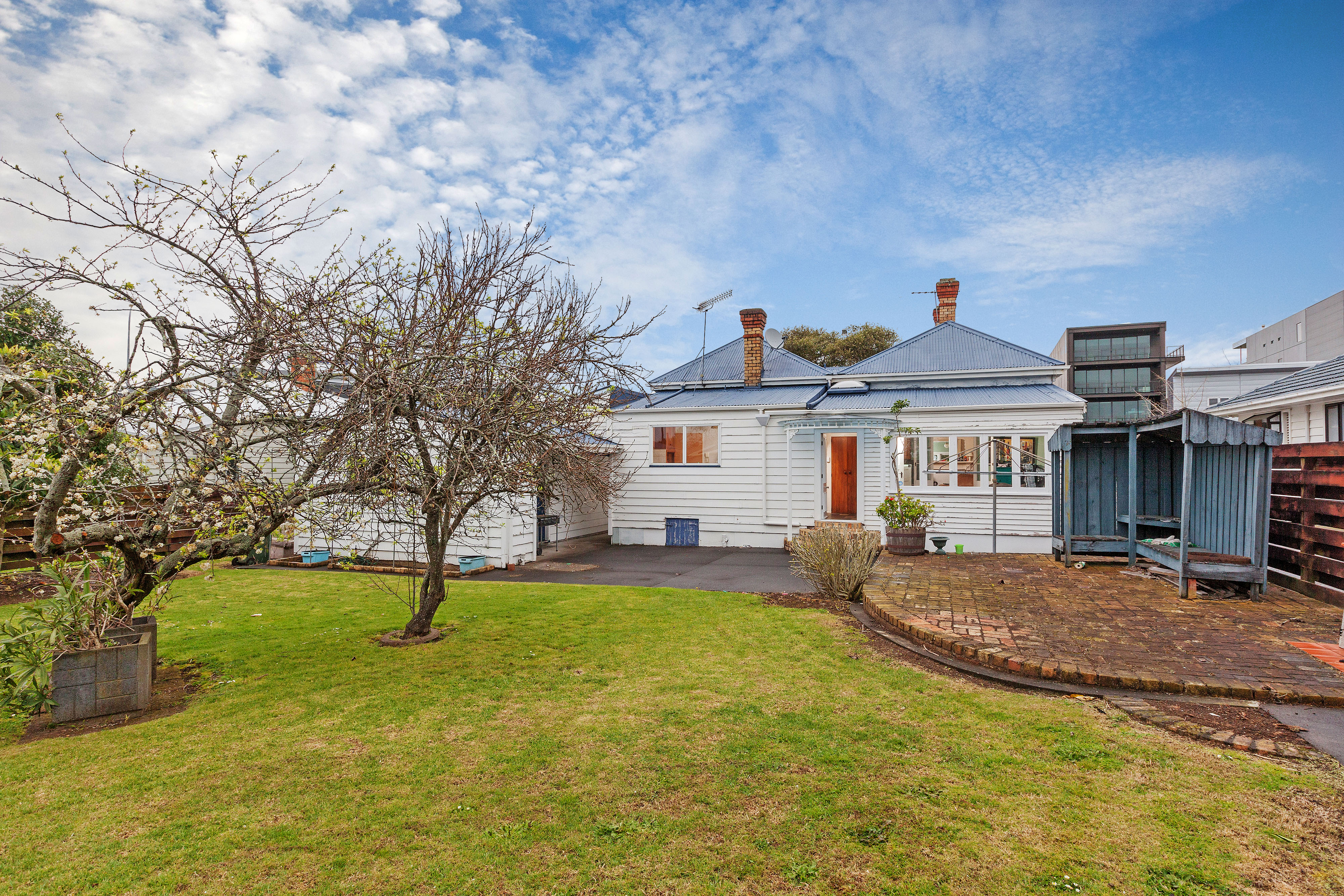
You are old now, 120 years or so, but you are still beautiful.  No trip to Auckland is complete without walking slowly by, admiring you lovingly from the street, daring to put a hand on the white picket fence, and remembering …

 Ellerslie Oct 12

At a busy Auckland intersection called The Harp of Erin (although the pub which gave it its name is long gone), Main Highway swoops down towards the suburb of Ellerslie. In the 1920s my maternal grandparents moved to a lovely old house at 100 Main Highway, just past the Catholic Church: this is where I was born in 1952, and where my first memories originate. I wasn’t actually born there, but rather nearby in Cornwall Hospital. However my mother was the seventh and last of my grandparents’ daughters  and she was born in the house in Ellerslie, as were two of her older sisters and their only brother, Jim, the baby of the family. When my grandparents moved to Auckland from Tauranga, travelling overnight on the Ngapuhi, they already had four daughters: when Jim was born in 1928 Nellie, the oldest of the seven sisters, was 17 years old. So by the time I arrived in the next generation, the house was already well-loved by our family.

 img 031 All together for the last time  12 3 1939 033

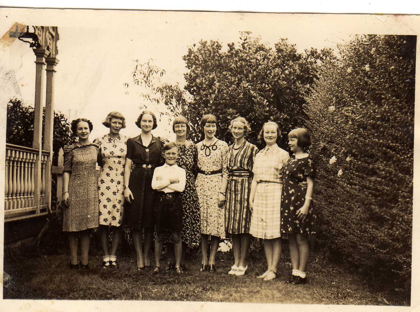
My grandmother, centre, with her seven daughters and only son. My mother is far right, aged 13. The photo was taken in the garden in Ellerslie in 1939. It was one of the last times they were all together as Nellie, Winifred and Fay would soon move to new homes ‘overseas’. All the dresses that the girls are wearing in this photo were made by Laura, the second oldest sister, fourth from the right in the photo.

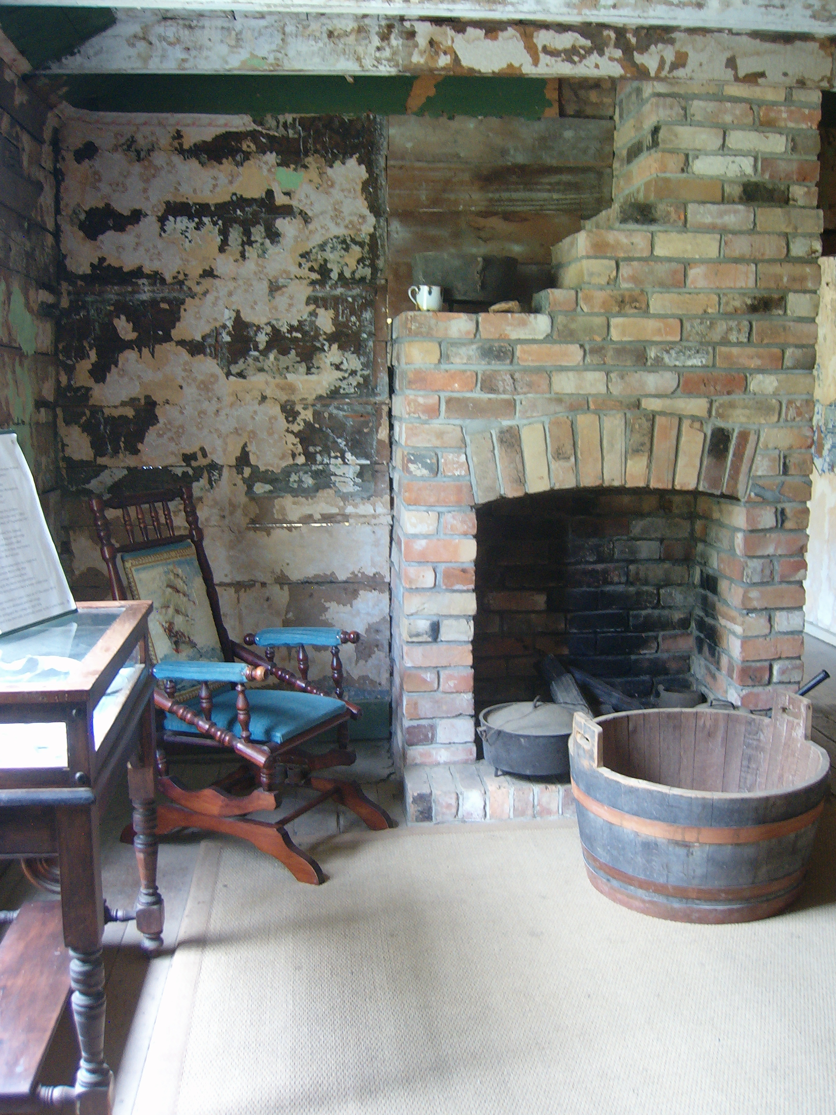
From my childhood I remember spacious rooms with gorgeous floral wallpaper, cosy fireplaces and warm, dark, wooden furniture. A magnificent well-worn kitchen table: a place for eating and ironing and cutting out dress patterns, for writing and playing and for setting the world to rights. Around this table I imagine my aunts’ and my mother’s suitors were vetted, and my uncles – and eventually my father – were judged suitable.

100B1428 

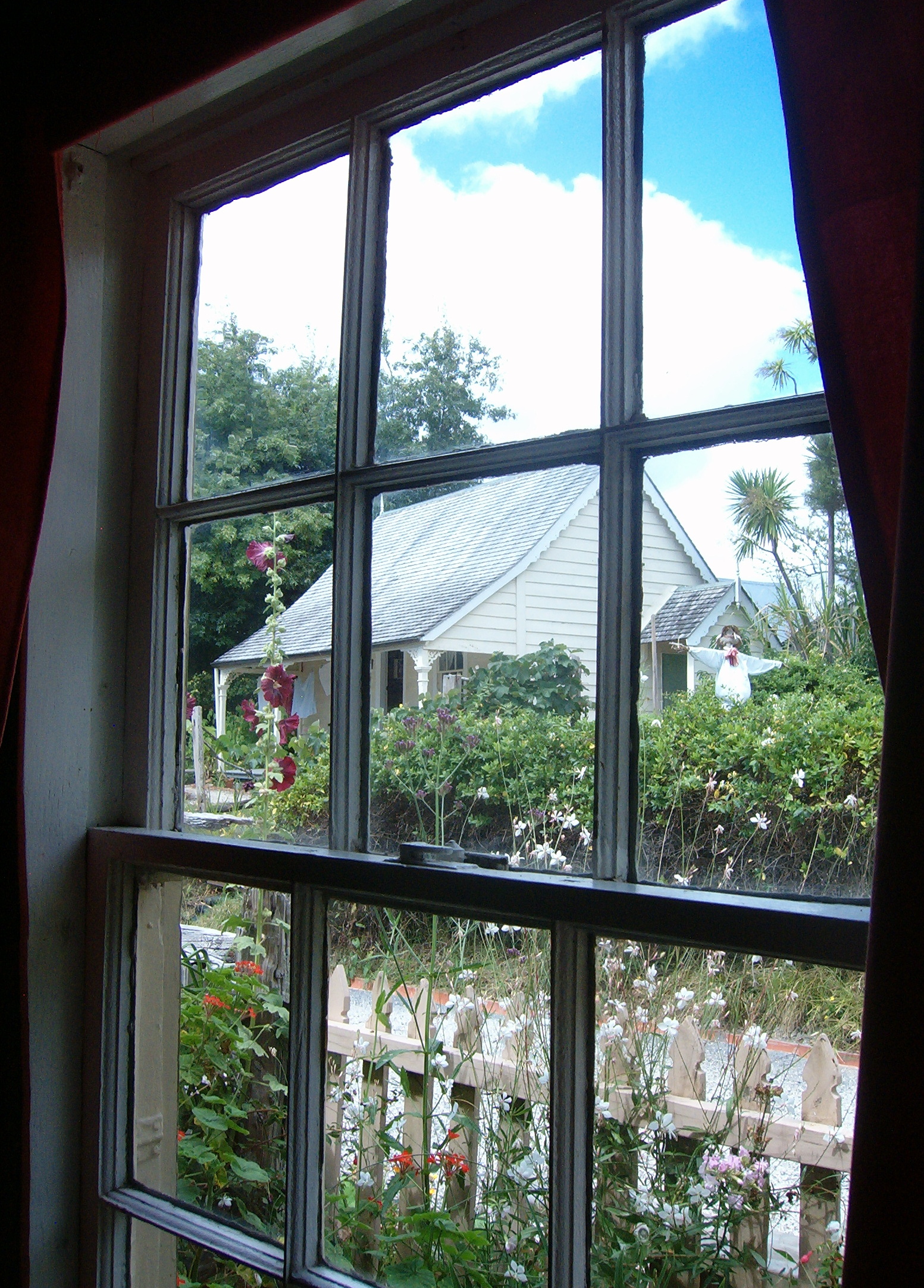
The little path from the front gate leads to a verandah with delicate fretwork around the eaves.

100B1454

I remember very clearly waiting happily, hopping with excitement, on the verandah with my grandmother holding my hand: my parents were bringing my new-born brother home. It was January 1955. Sometimes people say I was far too young to remember that, but I’m convinced that I do: my grandmother’s joy was easily transmitted to me.

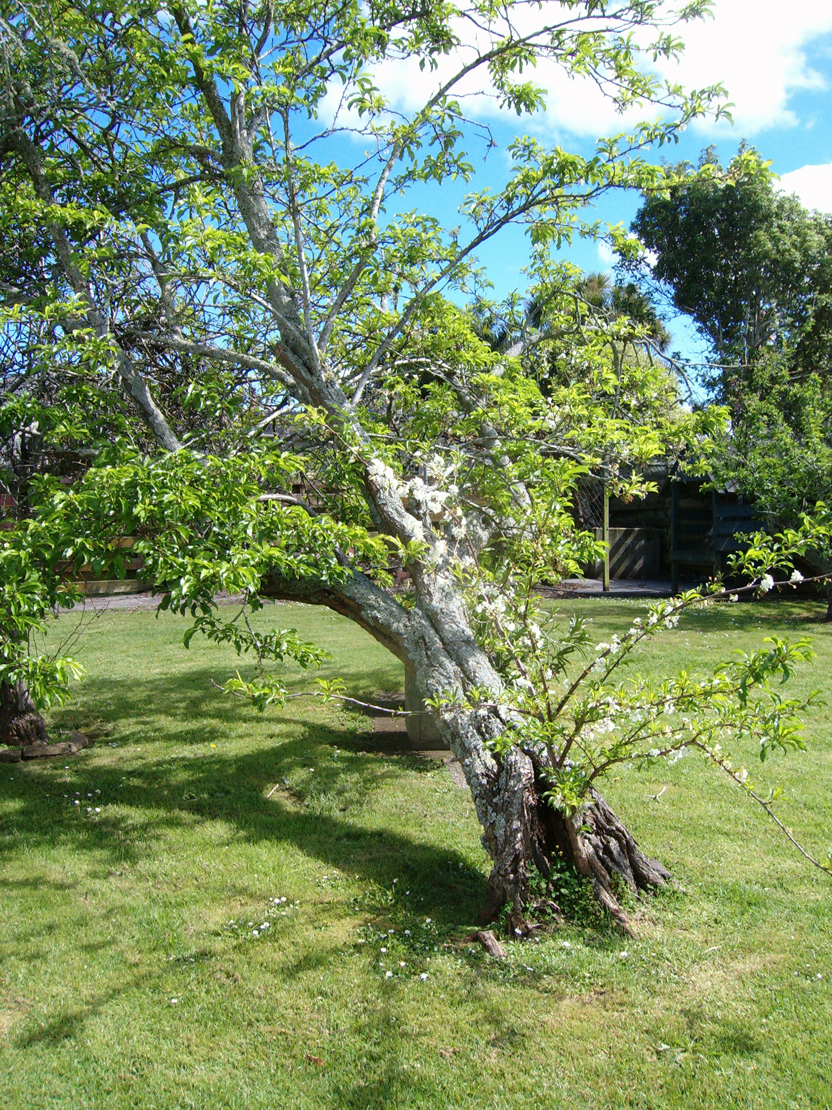
In due course Lance and I would play our games up and down the wonderful central corridor, clattering around on the back verandah and bounding down the steps into the back garden. A back garden for a carefree childhood: a vege patch, flowerbeds and an enormous plum tree to clamber about in.

100B1442 100B1444

Although showing signs of age, the plum tree is still blossoming and bearing fruit.

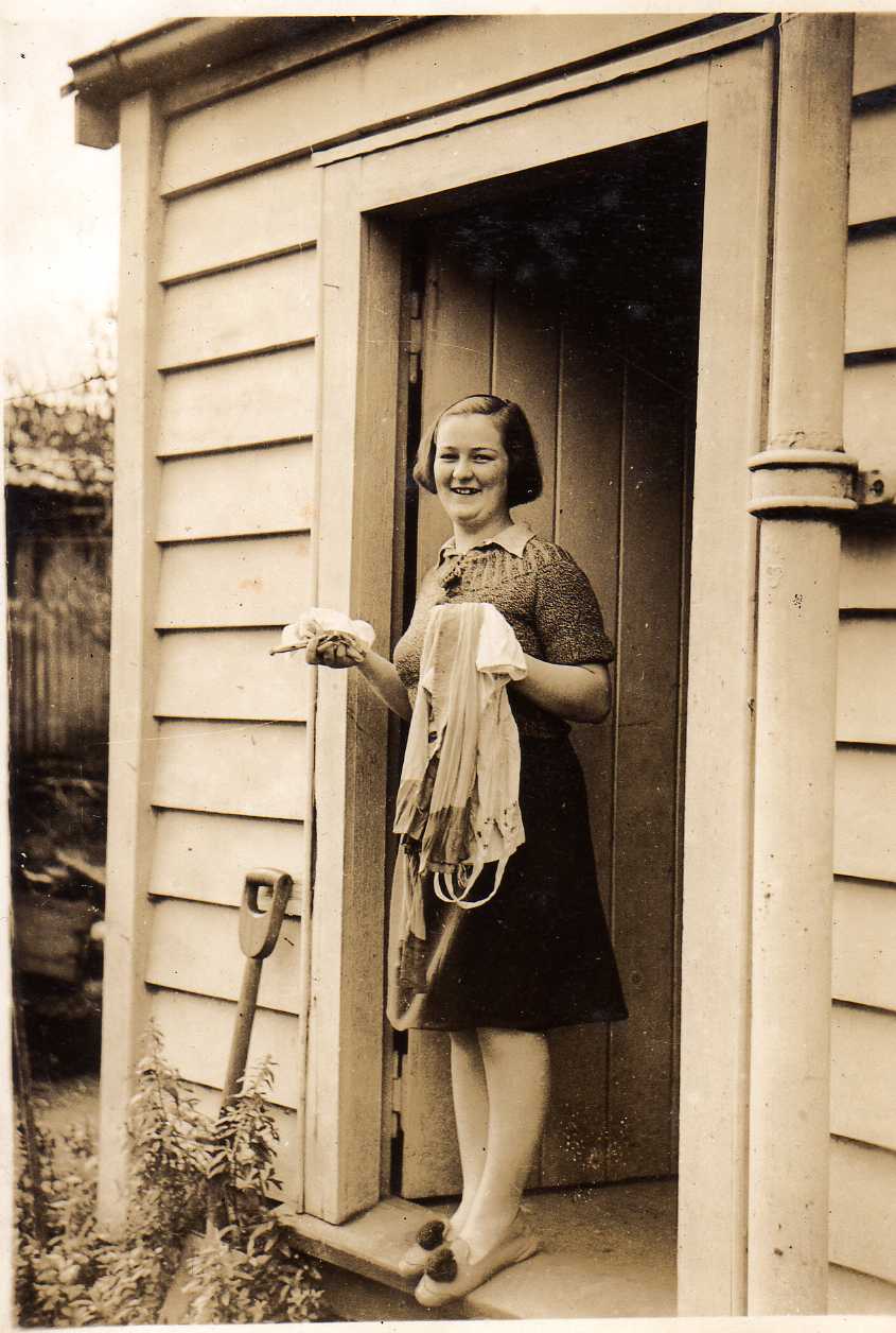
Over the back fence trains rattling north and south. There were two outhouses – the original toilet, although by then we had an indoor one as well, and the wash-house complete with its massive copper: this was an antiquated laundry arrangement which as a child I regarded with awe, little appreciating my grandmother’s drudgery of having had to light a fire under it and keep it stoked while doing the washing for a family of 10.

img Hilda 10 10 1942

My mother, aged 16, at the laundry in the back garden, October 1942

Best of all Lance and I had our Auckland cousins to share all this with – when they came to visit we would all snuggle up with our grandmother on the back steps and someone’s Brownie Box would capture our grinning faces: not that it was easy to get us all looking the same way at once – as any handful of photos of the same moments will show.

img 031 someone's birthday 1955 or 56034

6 Auckland cousins and our grandmother, on the back steps at Ellerslie, 1955. That’s me centre left and Lance is the baby. 

 Not long after I started school we moved away from Ellerslie. Until my grandmother sold the house, going back to sleep over with her was a treat for my brother and me.

While all around modern constructions have convulsed 100 Main Highway’s setting, the house remains unscathed: the picket fence and the gate, the front verandah and sash windows are just the same.  It’s a majestic house, still well cared for. Last year it was for sale and I was lucky enough to be able to spend some time inside and in the garden for the first time in over 50 years.

Ellerslie back 12

Camel milk chocolate

I did a double take as I strolled past this fabulous golden camel in Dubai airport’s departure lounge. Being a dark chocolate lover I bought the 70 gram, 70% cocoa bar, which contains 2% camel milk powder.

100B2441 100B2444 100B2446

Certainly not cheap, but very melt-in-the mouth, and my travel-food philosophy is that you can try anything once. Comparing the dietary information with the same amount of Whittaker’s Dark Ghana (72% cocoa) comes out higher in fat but lower in sugars.

Anyway, the golden camel got me looking around at some of the other souvenirs. There are camel for all ages and all tastes, and not only.

100B2449 100B2451 100B2461